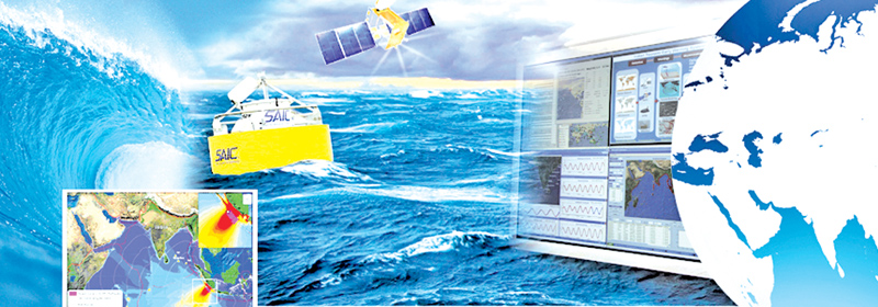
ESSO-Indian National Centre For Ocean Information Services (INCOIS), Hyderabad established in 1999 is an autonomous Society under India’s Earth Services Ministry. INCOIS which is considered as one of the best Ocean Information services centres in the world is mandated to provide the best possible ocean information and advisory services to society, industry, government agencies and the scientific community. Its major functions include issuing early warnings on tsunami, storm surge, high wave alerts to disaster management agencies, ports and harbour, and coastal population; issuing advisories to fishermen on potential fishing zones; Ocean state forecasting and providing special services for Indian Navy and Coast Guard. INCOIS’ state-of-the-art Indian Tsunami Early Warning Centre is one of the best Tsunami Service Providers responsible for providing tsunami services to the Indian Ocean rim countries (23 countries) including Sri Lanka. The centre which is in direct contact with Sri Lanka’s Meteorological Department, is a permanent member of UNESCO’s Intergovernmental Oceanographic Commission.
 INCOIS Director Dr. Satheesh C. Shenoi talks to the Daily News on topics ranging from INCOIS’ future projects and its role as a tsunami early warning centre in the region to disaster management in Sri Lanka including tsunami preparedness.
Q: ESSO-INCOIS which was established in 1999 provides round-the-clock monitoring and warning services for the coastal population on tsunamis, storm surges, high waves. However, tsunami wreaked havoc across South East Asia in 2004. How prepared were you back then to handle such situations? Were you able to issue tsunami early warnings?
A: Yes, INCOIS was established in 1999 with the mandate to provide ocean information and services to all stakeholders from fishermen to highly qualified professionals such as researchers, academicians, Coast Guard and Navy. Unfortunately, because the tsunami was not expected or never heard to occur in the Indian Ocean, tsunami early warning systems were not included in the activities of INCOIS at that time. However, when the large earthquake that led to the generation of devastating tsunami in the Indian Ocean struck on December 26, 2004, the government realised the importance of having an early warning centre for tsunami and that time, INCOIS was asked to take up the work and install one.
Today, we have a fully functional tsunami warning centre consisting of a network of earthquake monitors, tsunami wave monitors, etc. It is functional at INCOIS and is manned 24 hours. With such facilities, we are fully capable of detecting the earthquakes occurring anywhere in the world, especially in the Indian Ocean, within three to six minutes and issuing the bulletins within 8-10 minutes of the occurrence of an earthquake. The centre is also capable of detecting and reporting the tsunami waves within 20 minutes.
Q: How successful has the National Tsunami Early Warning Centre been in issuing early warnings (tsunami, storm surge and high wave alerts) and detecting earthquakes in the recent past? What are its main functions?
A: Realising the devastative potential of tsunamis, the Indian government directed the Earth Sciences Ministry to set up an early warning system at the earliest possible time at INCOIS. The National Tsunami Early Warning Centre (ITEWC), set up at INCOIS, has been operational since October 2007 and issues accurate tsunami advisories for all under-sea earthquakes of M = 6.5. Established a decade ago as an interim tsunami warning centre, it has become a world-class tsunami warning centre in no time, with a real-time network of seismic stations, tsunami buoys, sea level gauges and 24 X 7 operational warning centre to detect tsunamigenic earthquakes, to monitor sea-level changes and to provide timely advisories to vulnerable communities.
The state-of-the-art Indian Tsunami Early Warning Centre acts not only as a national nodal agency for tsunami advisories, but also as one of the Tsunami Service Providers responsible for providing tsunami services to the Indian Ocean rim countries (23 countries). Since its inception, the Centre has detected 475 earthquakes of M > 6.5 in the world oceans and 68 earthquakes in the Indian Ocean and issued appropriate warnings/advisories to the concerned authorities. To date no earthquake has neither gone undetected, nor ended up in issuing inappropriate tsunami warning. Also, the centre has always maintained the standards specified by IOC/UNESCO.
Q: How are tsunami early warnings issued?
|
|

A: The Warning Centre disseminates tsunami advisories to various stakeholders through multiple dissemination modes simultaneously (Fax, Phone, Emails, GTS and SMS etc.). Earthquake information, tsunami bulletins as well as real-time sea level observations are also made available on a dedicated website www.tsunami.incois.gov.in for officials, public and media. Users can also register on the website for receiving earthquake alerts and tsunami bulletins through emails and SMS. The ITEWC also assists the coastal states through education programmes and regular tsunami communication and evacuation exercises, increasing the coordination, readiness for understanding of tsunamis among stakeholders with special emphasis on school children and other coastal communities around the nation.
Warning Centre is constantly evolving with new strategies by focussing its efforts towards the development of new methodologies and warning procedures. The future work is focussed towards sea level inversion, real-time inundation modelling, use of near-field GPS measurements for real-time rupture characterisation and 3D mapping of vulnerable coastal areas.
Q: How does a tsunami warning system work?
A: The tsunami early warning system starts with the identification of the earthquake occurred at the bottom of the sea/ocean, estimation of its location, magnitude, depth inside the earth, etc. Once the earthquake is identified as high magnitude earthquake, our centre makes use of a mathematical model of tsunami wave propagation and determines whether that earthquake is capable of generating a tsunami and if so what are the expected tsunami wave heights all along the coast and when they are likely to reach. Based on that calculation, we issue the next bulletin if we find the estimated wave heights exceeds 2.0 m, at one or more locations (a location covers 50 km stretch of the coast). We issue the second bulletin informing about the likely tsunami and the locations where that might come under tsunami waves. The first bulletin is issued within 8-10 minutes, the second bulletin with tsunami information is issued within 15-20 minutes. By the time we issue the second bulletin, the tsunami waves, if produced, travels and reaches one or other tsunami buoy or a sea level gauge that is reporting data to INCOIS continuously and that information tells us whether a tsunami has been generated. That gives us the confirmatory message as well as the opportunity to provide more accurate tsunami information in the subsequent bulletins. This is the sort of procedure that we follow. Though seemingly simple, the issues are very complicated, like the quickness in the estimation of earthquake details, estimations using a tsunami model, reception of data from the sensors scattered all over, maintenance of those observing system, communication channels, etc.
Q: One of the main objectives of INCOIS is to carry out surveys and acquire information using satellite technology. How are Indian and American satellites used to obtain data?
A: Rather than carrying out surveys, our objective is in utilising the data gathered from in situ (the sensors out at oceans) and remote sensing satellites to derive information. For example, we use the data from satellites to produce the Potential Fishing Zone advisories that inform the fishermen where they can expect abundant fish. Similarly, we assimilate the data from satellites as well as from the in situ platforms in the mathematical models that we use to forecast the sea state during next five to seven days. To receive the data from Indian (Oceansat) as well as American satellites, we have three ground stations on our campus.
Q: In which ways does INCOIS provide its services to its nearest Southern neighbour, Sri Lanka?
A: We do issue tsunami early warnings and ocean state forecasts to Sri Lanka.
 The north-west coast of Sri Lanka is most of the time under the influence of high wind waves and swell waves, the situation getting compounded during the spring tides, particularly along the low lying areas. The country has also been affected mostly by cyclone activity occurring in the Bay of Bengal. Even though not frequent, the eastern, northern and north central regions have been identified as cyclone-prone areas of Sri Lanka. Sri Lanka is also under the influence-high winds and waves associated with the southwest monsoon season. There is an urgent need to provide timely and accurate forecast information on ocean state and marine meteorological parameters for a wide spectrum of users such as fishermen, ports and harbours, tourism departments, defence, coast guard and shipping for this island country with a relatively long coastline.
To cater to these needs, Earth Sciences Ministry of the Indian government developed an integrated high resolution ocean forecasting system for Sri Lanka through INCOIS and Regional Integrated Multi-hazard Early-warning Systems (RIMES). The forecast is available to the users three days in advance at three to six hour temporal resolution for wind, waves, currents, the temperature in map form for the region.
These forecasts are updated daily on operational basis. In addition, location-specific forecast products are available for the following locations; Kalpitiya, Chilaw, Negombo, Dikkovita, Mutwal, Panadura, Beruwala, Ambalangoda, Hikkaduwa, Dodanduwa, Galle, Mirissa, Puranawella, Nilwella, Kudawella, Tangalle, Hambantota, Kirinda, Valachchanai, Cod Bay, Oluvil and Suduwella.
Most of these locations are fishing harbours.
Further, High Wave Alerts would be issued during situations when the waves are likely to be high, close to the shoreline. Development of Standard Operating Procedure for providing High Wave Alerts, tidal flooding and wave surge warning is in progress.
Q: ESSO-INCOIS has a prominent international presence, being a permanent member of the Indian delegation to IOC of UNESCO and a founding member of the Indian Ocean Global Ocean Observing System (IOGOOS) and the Partnership for Observing the Oceans (POGO). What role does INCOIS play as a permanent member of UNESCO’s Intergovernmental Oceanographic Commission?
A: As a member of IOC/UNESCO, we do help the other members in collaborating with us, in building their capacity, engage in training programmes, etc. The ocean state forecasts and tsunami early warnings that we are providing to other countries is another example. We offer free training to other countries in operational oceanography through the courses that we organise at the International Training Centre for Operational Oceanography (ITCOocean). If I remember correct, we must have trained about 15-20 participants from Sri Lanka during the last three to four years.
Q: A recent study conducted by the Guardian, UK convincingly quantified how much the Earth has warmed over the past 56 years. Earth’s oceans are warming 13% faster than thought, and accelerating, the new data revealed. This can definitely affect sea levels, coastlines, ocean acidification, ocean currents, seawater, sea surface temperatures, and trigger many changes in ocean bio-geochemistry. How sensitive is INCOIS to these changes? Do you conduct researches on these areas?
A: We have conducted limited studies on these aspects, but now we are proposing a new project on the aspects of climate change to the Indian government. Basically, we want to understand the accelerated warming of Indian Ocean, how that is going to affect the future sea level, biogeochemistry, etc and see whether we can make long-term predictions on such changes.
Now we are in the process of brainstorming and preparing a detailed project report for its submission to Earth Sciences Ministry of the Indian government by the end of November. The proposal will undergo an independent scrutiny by experts and that process might take a couple of months and later the financial approvals. If everything goes well, we are expecting to get the approvals in April-June 2018. The results are expected to start from the third year of the project.
Q: It is said that sea waves and precipitation patterns have changed dramatically over the years. Do you find major changes in the wave patterns of the Indian Ocean of late?
A: Yes, our preliminary studies suggest that the wave heights have increased over a period of time and the Indian Ocean is warming at a larger rate than other oceans. Some of our research, as well as the research papers, appeared in the research journals from elsewhere are suggesting the transfer of heat from the Pacific to Indian Ocean (IO) through the Indonesian region. But the questions remain whether it is true that IO is warming at a higher rate because of the accelerated transfer of heat from Pacific. If so, what is causing that acceleration? How much heat is getting transferred? What would be the fate of that excess heat getting accumulated in the IO? How will that heat influence the sea level, weather, climate and biogeochemistry of the IO? Whether there is an increase in waves? If so whether that is happening all over the IO or only at a few locations? What could be the reasons for such an increase? Finally, we want to use mathematical models to reproduce these observations and extend them further to predict the changes over next decades. These are the kind of issues we are trying to address in the new project that we are proposing.
Q: One of your activities is training and capacity-building for students, young researchers in India and Indian Ocean Rim Countries through short and long duration training courses. What’s the enrolment procedure?
A: Enrolment procedure is simple. We announce the forthcoming courses on our website (http://www.incois.gov.in/ITCOocean/index.jsp) as well as through emails to the contacts calling for applications. Based on the course content and the basic qualification and nature of work of the applicant, a committee selects the participants.
Q: As a responsible body that conducts systematic quality checks and carries out research on the patterns and trends in ocean health, what predictions can you make about the changing weather patterns, oceans and its motion?
A: India Meteorological Department under MoES is the responsible agency to make the predictions of weather and INCOIS is responsible for providing information about the changes that are happening in the oceans, namely ocean state forecasts. Right now we are predicting the changes in the oceans up to seven days in advance using the ocean models forced with forecasted atmospheric parameters. If the forecasted atmospheric parameters (winds, heat fluxes) are available for longer periods, we too will be able to provide the forecasts of ocean state for longer periods.
Q: Is another tsunami in the offing? There are certain reports in the web which say that a large earthquake will strike in the Indian Ocean and cause a deadly tsunami before the end of 2017. Can a tsunami be predicted before an earthquake happens?
A: There are no scientific evidence to support such reports. As such no tsunami can be predicted before the occurrence of earthquakes. We are fully prepared to predict the tsunamis when a large earthquake occurs on the seafloor.
Q: INCOIS is considered as one of the best Ocean Information Services Centres in the world. Based on your expertise, what are your recommendations for Sri Lanka with regard to disaster management, early warning systems and potential fishing zones?
A: Disaster management is as important as the early warnings. Hence, it is necessary to prepare detailed disaster management plans involving the civil administration and community. To prepare the disaster management plans it would be necessary to assess the risk of vulnerable localities on the coast.
Regarding the potential fishing zones, certainly, it would be beneficial to adopt the technologies to generate such advisories. We will be happy to impart training in these areas.
Q: Has Sri Lanka identified such vulnerable localities on the coast? Have the authorities sought your advice in this regard? Can you name such vulnerable localities on the coasts of Sri Lanka?
A: As I understand, some work in that direction has been done in Sri Lanka, but I have no idea on how far that has been done. I had opportunities to listen to Professor Sam Hettiarachchi of Moratuwa University at some of the meetings about the tsunami risk assessments carried out in Sri Lanka.
Of course, if vulnerable areas are identified, a detailed plan of action including evacuation plans, safer routes for evacuation, how link departments should act during an emergency, etc. should be prepared. More importantly, such communities should be educated about the risk and what they should do in such eventuality. Periodic mock exercises involving the community will be a good option to prepare the community to face the eventualities and also to keep the entire civil administration well oiled.
Q: What are the main issues faced by fishermen both in India and Sri Lanka?
A: The major problems faced by the Indian fishermen are low catches, higher expenses in fishing and timely sale of catch at competitive prices. Second is the safety at sea due to bad seas. The PFZ advisories and ocean state forecasts provided to the Indian fishermen addresses both the issues to a large extent. I guess the problems faced by the Sri Lankan fishermen are also similar.
(Seventeen Sri Lankan Print and Electronic media Journalists visited INCOIS, Hyderabad during a recent Familiarization Tour of India jointly organised by the Indian High Commission in Colombo and the External Affairs Ministry, India)
Add new comment